


Manannah Twp. Voting District, Meeker County, Minnesota
About
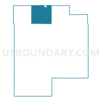
Outline

Summary
| Unique Area Identifier | 603142 |
| Name | Manannah Twp. Voting District |
| County | Meeker County |
| State | Minnesota |
| Area (square miles) | 38.60 |
| Land Area (square miles) | 38.25 |
| Water Area (square miles) | 0.35 |
| % of Land Area | 99.09 |
| % of Water Area | 0.91 |
| Latitude of the Internal Point | 45.27690510 |
| Longtitude of the Internal Point | -94.57209240 |
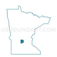
Maps

Graphs
Select a template below for downloading or customizing gragh for Manannah Twp. Voting District, Meeker County, Minnesota


Neighbors
Neighoring Voting District (by Name) Neighboring Voting District on the Map
- Eden Lake Twp. Voting District, Stearns County, MN
- Eden Valley Voting District, Meeker County, MN
- Eden Valley Voting District, Stearns County, MN
- Forest Prairie Twp. Voting District, Meeker County, MN
- Harvey Twp. Voting District, Meeker County, MN
- Luxemburg Twp. Voting District, Stearns County, MN
- Paynesville Twp. Voting District, Stearns County, MN
- Swede Grove Twp. Voting District, Meeker County, MN
- Union Grove Twp. Voting District, Meeker County, MN
Top 10 Neighboring County Subdivision (by Population) Neighboring County Subdivision on the Map
- Eden Lake township, Stearns County, MN (1,542)
- Paynesville township, Stearns County, MN (1,421)
- Forest Prairie township, Meeker County, MN (972)
- Luxemburg township, Stearns County, MN (637)
- Union Grove township, Meeker County, MN (633)
- Manannah township, Meeker County, MN (604)
- Eden Valley city, Meeker County, MN (553)
- Eden Valley city, Stearns County, MN (489)
- Swede Grove township, Meeker County, MN (400)
- Harvey township, Meeker County, MN (374)
Top 10 Neighboring Place (by Population) Neighboring Place on the Map
Top 10 Neighboring Unified School District (by Population) Neighboring Unified School District on the Map
- Litchfield Public School District, MN (11,597)
- Paynesville Public School District, MN (6,164)
- ACGC School District, MN (5,881)
- Eden Valley-Watkins School District, MN (4,886)
Top 10 Neighboring State Legislative District Lower Chamber (by Population) Neighboring State Legislative District Lower Chamber on the Map
Top 10 Neighboring State Legislative District Upper Chamber (by Population) Neighboring State Legislative District Upper Chamber on the Map
Top 10 Neighboring 111th Congressional District (by Population) Neighboring 111th Congressional District on the Map
Top 10 Neighboring Census Tract (by Population) Neighboring Census Tract on the Map
- Census Tract 111, Stearns County, MN (7,042)
- Census Tract 112, Stearns County, MN (6,487)
- Census Tract 110, Stearns County, MN (3,901)
- Census Tract 5605, Meeker County, MN (3,270)
- Census Tract 5606, Meeker County, MN (2,941)